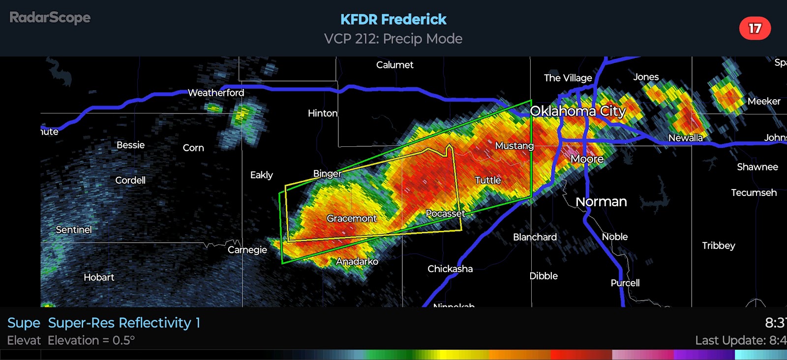
2024/06/04 - LIVE BLOG: Significant Hail & Wind Likely In Oklahoma Through Tonight
8:40 PM CDT UPDATE - Incredible cluster of supercells south of I-40 are producing Large Hail and Damaging Winds. There are a few areas of rotation that I am watching, especially near Anadarko.
This is a look from where I am, well to the north... Amazing.
5:05 PM CDT UPDATE - The NWS has issued a Severe Thunderstorm Watch for a good portion of Oklahoma. It is in effect until midnight CDT.
4:25 PM CDT UPDATE - Convergence is increasing near the triple point late this afternoon. You can see the agitated cumulus field near Clinton on satellite. The area I have highlighted is where development is likely to occur between 5:00 and 6:00 PM.
Surface instability is phenomenal right now across parts of the state. The latest mesoanalysis shows over 7,000 j/kg of SBCAPE near Chickasha. The environment is a powder keg and will be very supportive of Severe Weather near and east of the triple point. The marginal shear will be offset by the presence of such extreme instability and surface boundaries for a Tornado Risk. Because traditional model Tornado parameters are based on shear as well as instability, there may be an underestimation of how favorable the environment is for a couple Tornadoes this evening.


Comments
Post a Comment