2024/05/21 - Severe Weather Expected Through Memorial Day Weekend
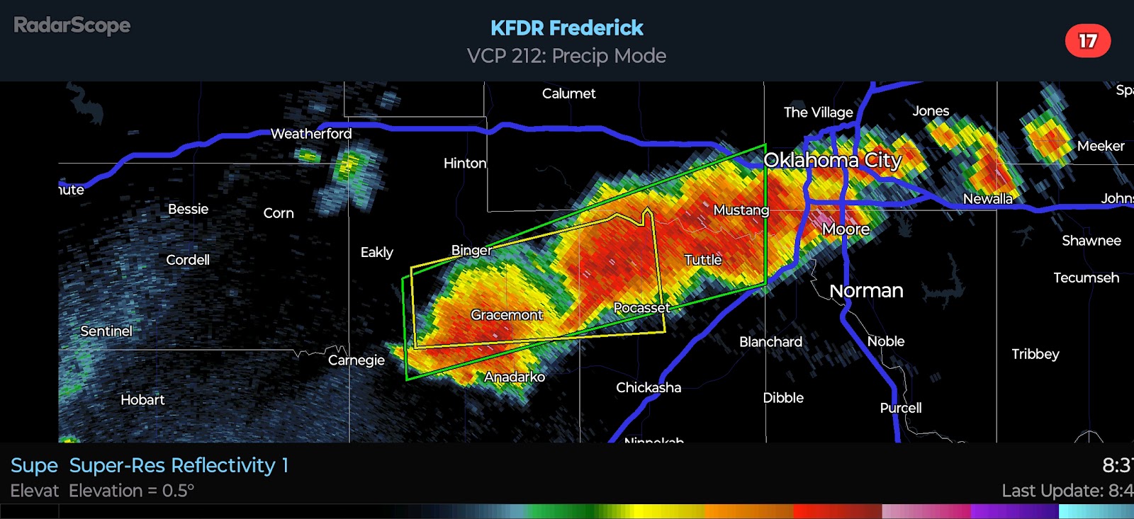
3:00 PM CDT | May 21, 2024 - Busy, busy, busy! We have a dryline that is moving through Central Oklahoma this afternoon. A very unstable environment exists along/ahead of this boundary. Expect storms to zipper down the boundary between 4:00 and 6:00 PM. Supercells capable of all hazards will be possible. The boundary will slosh back toward the west with the loss of daytime heating, but a cool front will be moving through North Central Oklahoma as well. This boundary will merge with the retreating dryline near I-40 after dark.
A second disturbance will arrive from the west late tonight/tomorrow morning. This is where the forecast gets "fun" as some models show the boundary stalling/lifting back just north of the I-40 corridor overnight in response to height falls from the west. Other models show the boundary continuing to slowly sink southward. Why is this crucial? Because activity is expected to develop during the predawn hours. The risk for Severe Weather will increase prior to daybreak Wednesday. All hazards will be possible along and south of the boundary. Strong elevated instability will exist just north of the frontal boundary for a risk of Quarter to Golf Ball-size Hail and a low Damaging Wind threat. Worth noting is that radar pulsing was noted for several hours yesterday morning across Southwest/West Central Oklahoma. This is the ionization or "charging" of the atmosphere ahead of the expected development.
Strong to Severe Storms will be ongoing at daybreak to start the Day 2 period. The greatest risk will be across the Enhanced Risk area with an emphasis on North Texas/Texoma into the Ark-La-Tex region. Multiple arrays from the Shreveport, LA radar have been noted today toward NE TX, SE OK, and SW AR. A couple Strong Tornadoes will be possible tomorrow afternoon/evening - in addition to Very Large Hail and potentially significant Damaging Winds.
Thursday looks very interesting for Oklahoma as the frontal boundary lifts northward, expanding the warm sector through much of the state by late Thursday afternoon. The SPC has a Slight Risk in place for most of the state. All hazards will be possible. There are a couple different scenarios that could unfold, and I will be watching for chemtrailing and radar pulsing closer to the event. I believe an Enhanced Risk will be warranted for portions of Oklahoma in later outlooks.
Friday may be a "lull" day with the next opportunity for organized Severe Weather looking like Saturday. The SPC has a Slight Risk for Southeast Oklahoma on Saturday. It appears reasonable for them, but I do believe the risk will extend westward through at least the US 281 corridor of Northern/Central Oklahoma. This puts the current highlighted area anywhere from 80-150 miles too far to the south and east.


.png)


Comments
Post a Comment