2024/05/06 - LIVE BLOG: Severe Weather Outbreak Today
LIVE BLOG
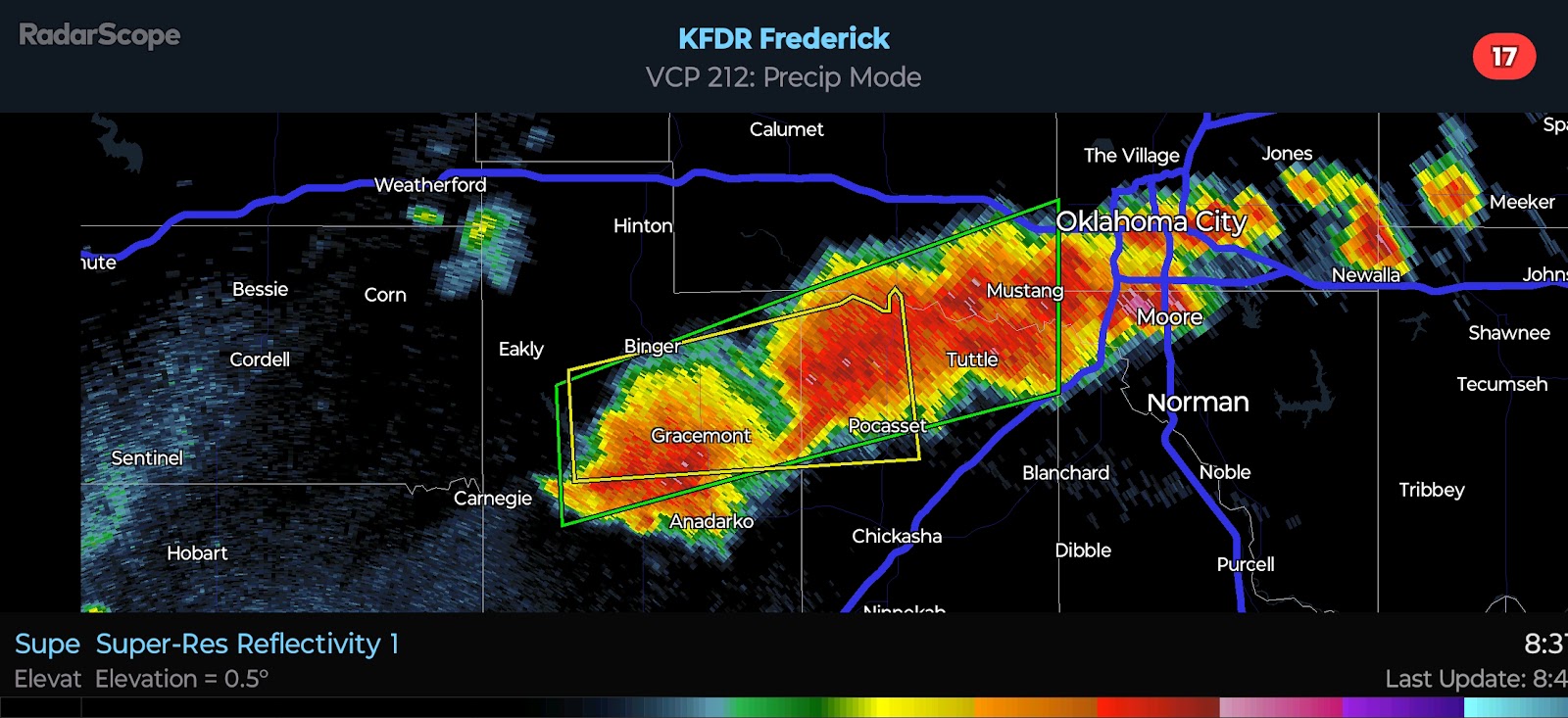
6:50 PM CDT UPDATE - Several Supercells are ongoing in Northwest Oklahoma right now. Additional storms have recently developed near and to the south of Elk City. The risk for Strong/Violent Tornadoes continues to increase early this evening. I am especially concerned with the southern flank of the Supercell cluster as cells will have uninhibited access to the moist, unstable environment in place to the south and east. Whether this southern flank tracks right along the I-40 corridor or perhaps just north, remains to be seen. The risk for Significant Severe Weather continues across the entire PDS Tornado Watch area.
3:40 PM CDT UPDATE - Strong to Severe Storms are ongoing from NW OK through WC KS... Additional cells are trying to develop in the SE TX Panhandle and far SW OK. Activity is currently lifting NE but will turn more toward the east as updraft rotation increases. The southern area that is highlighted in yellow would pose the greatest risk to the I-40 corridor, but cells are taking longer to initiate as they are more removed from the greatest forcing and lift.
2:15 PM CDT UPDATE - The SPC/NWS has issued a PDS Tornado Watch for Western and Central Oklahoma, as well as adjacent parts of far NW Texas and SC Kansas. This watch is in effect until 11:00 PM local time. I have attached the watch text below, copied straight from the SPC website.
SEL9

   URGENT - IMMEDIATE BROADCAST REQUESTED
   Tornado Watch Number 189
   NWS Storm Prediction Center Norman OK
   200 PM CDT Mon May 6 2024

   The NWS Storm Prediction Center has issued a

   * Tornado Watch for portions of
     Southern Kansas
     Western and Central Oklahoma
     Western North Texas

   * Effective this Monday afternoon and evening from 200 PM until
     1100 PM CDT.

   ...THIS IS A PARTICULARLY DANGEROUS SITUATION...

   * Primary threats include...
     Numerous tornadoes expected with a few intense tornadoes likely
     Widespread large hail and scattered very large hail events to 4
       inches in diameter likely
     Scattered damaging winds and isolated significant gusts to 75
       mph likely

   SUMMARY...Explosive thunderstorm development is forecast this
   afternoon along and east of a north to south oriented dryline.
   Given a very favorable environment for severe thunderstorms, intense
   supercells are expected to evolve.  These storms are forecast to
   move east across the Watch area this afternoon through the late
   evening.  The possibility exists for regenerative supercell
   development over central Oklahoma this evening.  Initially large to
   giant hail is forecast with the initial supercell activity before
   the tornado risk increases.  Intense tornadoes are probable
   especially as the atmosphere becomes very favorable for tornadoes
   late this afternoon and continuing through the evening.

   The tornado watch area is approximately along and 105 statute miles
   east and west of a line from 25 miles north northwest of Hutchinson
   KS to 50 miles south southeast of Fort Sill OK. For a complete
   depiction of the watch see the associated watch outline update
   (WOUS64 KWNS WOU9).

   PRECAUTIONARY/PREPAREDNESS ACTIONS...

   REMEMBER...A Tornado Watch means conditions are favorable for
   tornadoes and severe thunderstorms in and close to the watch
   area. Persons in these areas should be on the lookout for
   threatening weather conditions and listen for later statements
   and possible warnings.

   &&

   OTHER WATCH INFORMATION...CONTINUE...WW 187...WW 188...

   AVIATION...Tornadoes and a few severe thunderstorms with hail
   surface and aloft to 4 inches. Extreme turbulence and surface wind
   gusts to 65 knots. A few cumulonimbi with maximum tops to 500. Mean
   storm motion vector 24035.

   ...Smith
12:20 PM CDT UPDATE - PDS (Particularly Dangerous Situation) Tornado Watch is expected to be issued across Western/Central Oklahoma and adjacent parts of far NW TX & SC KS.
12:00 PM CDT UPDATE - The Storm Prediction Center upgraded parts of Oklahoma and Kansas to a High Risk. This is the first High Risk that has been issued for the region since 2019. This should not come as a surprise if you have been following the blog. The official outlook graphic has been posted below.
The latest satellite imagery shows increasing lift ahead of our system. Agitated cumulus clouds are noted in the Texas Panhandle along the dryline that is shifting eastward. Storm initiation is expected soon from the eastern Oklahoma Panhandle into Kansas. Initiation along the dryline near the TX/OK border is likely around 3:00 PM. There is a low probability for isolated storms to form in West Central Oklahoma, ahead of the boundary. Any storm that gets going would be capable of all hazards as it lifts north and northeast. The main event will be later, however.


Comments
Post a Comment