2024/05/04 - Widespread Rainfall Into Sunday; Eyes On Monday
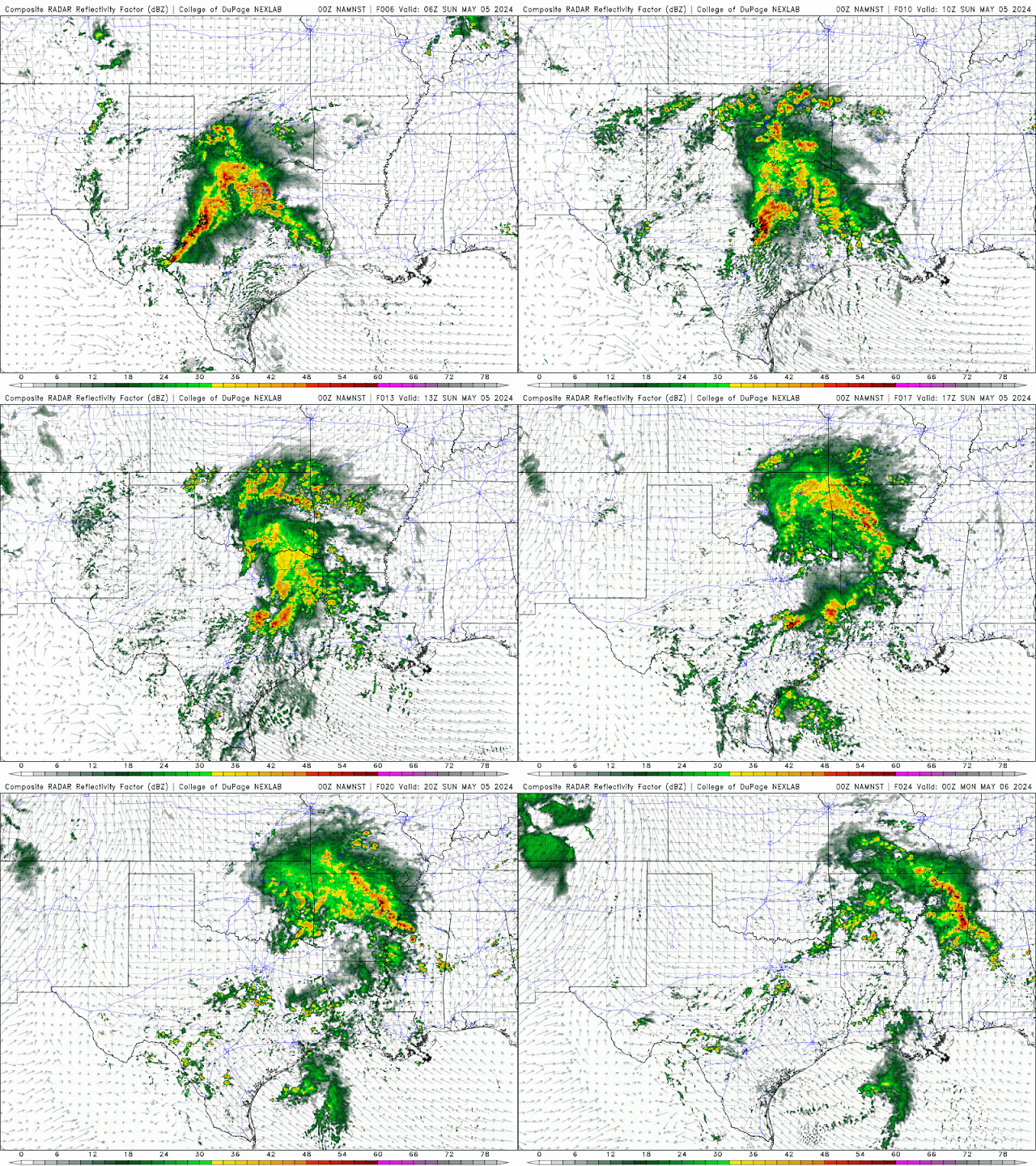
10:10 PM CDT | May 4, 2024 - A system impacting Texas right now will bring more widespread rainfall to Oklahoma overnight. The risk for severe weather is very low, but isolated instances of hail and wind are possible. The tornado risk is very low. I have attached a loop from one of this evening's weather models, which shows the simulated radar from 1:00 AM to 7:00 PM Sunday. Keep in mind that this is just a weather model and that it is only to give you an idea of what will unfold. Don't get too focused in on the exact locations. :)
Attention then shifts quickly to Monday's (potentially) Significant Severe Weather Outbreak. If you read last night's discussion, you will remember that I stated it was likely that the Enhanced Risk would be adjusted southward in later outlooks. They did just that early this morning. You can see the latest outlook below. I would not be surprised to see parts of Northern and Central Oklahoma upgraded to a Moderate Risk in later outlooks.
The general trend with the model guidance today has been more aggressive with storm development along the dryline late Monday afternoon and evening. I do believe we should see at least a 40-50% coverage off the dryline because... it will be difficult for a strong cap to get established less than 24 hours from major overturning of the atmosphere with the current weather-maker. The cap is warm, dry air above the surface. It comes off the higher terrain in Northern Mexico when there is southwesterly flow aloft. The atmospheric overturning in West Texas and Oklahoma will help to slow the establishment of this coming warm, dry air ahead of the Monday system.
Regardless, the environment will be favorable for supercells capable of Quarter to Softball-size Hail (possibly larger), Damaging Winds of 60-80 mph, and Tornadoes. There is the potential for a few Strong Tornadoes as well. This potential will be maximized around/after sunset as the low-level jet strengthens. The risk for Severe Weather will continue through Monday night; however, the risk for significant impacts will gradually decrease after midnight.
I will no doubt be sharing more of my thoughts as we get closer. On Monday, I will be posting multiple updates as things get underway.


Comments
Post a Comment